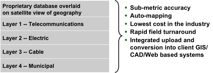
xpoGIS provides multi-layer infrastructure surveys in the format that is requested by our clients. |
 |
- We combine comprehensive knowledge of telecommunications, information systems and work force management
- We deliver “breakthrough” efficiency, scope, and accuracy by leveraging GPS interfaces and handheld technology
- Our technical expertise ensures surveys with sub-foot accuracy, ranging from field inventory thru conversion into client GIS/CAD/Web-based inventory systems at the lowest cost in the industry
- We collaborate with national and local utilities, utility service companies and municipalities/government agencies to complete implementation
- We build real time solutions that overcome day-to-day challenges of managing inventory systems
Services include:
|
|